Geographically, Peru is divided into three main regions. The first of these, the Coast, is a narrow strip of desert between the sea and the foothills of the Andes. Due to the influence of the Humboldt Current, coming from the Antarctic, and does not allow the formation of clouds by low temperature, the climate of the coast is rather cold and the lack of rain, mostly desert, crossed by small rivers, most of which only have water in the summer months and form small oases longitudinal.
A vision of Peru and its wonders!
Despite this the Costa or Chala is relatively more populated area, although only a small percentage of the territory. In the valleys and irrigation, land is extremely fertile, and 900.000 hectares are exportable agricultural wealth of Peru (sugar, cotton, asparagus, grapevines, etc.)…
The Peruvian coast is covered in fog between the months of May through October that form a sort of drizzle called «drizzle» by Peruvians. It also costs the region of the guano birds and fish wealth, having arrived in Peru to be the world’s largest producer of fishmeal and fish oil in a bygone era known as the fishing boom.
The Sierra contains a significant proportion of the population, while it is true that important part of it is out of the benefits of technology. Starting around 700 meters, reaches an average height of 4,000 meters, it is good to note that since the 3,500 meters at the 4000 region is already known as Sunnis or Jalca. More than ten peaks of the 6,000 m pass protruding including Huascaran (6,768 m).
La Sierra or Quechua is crossed by major rivers and is full of lakes, which later form the Amazon river network. In its plateaus and mountains in the Indian population lives, the direct descendants of the ancient Peruvians and mestizos formed by mixtures of Spanish and indigenous race. Mostly engaged in smallholder agriculture and livestock, are also involved in large mining industry.
In the Sierra also located on Lake Titicaca, a place inhabited by the Uros, which involves national and sentimental value: It is there as the Quechua tradition, related by the first historian mestizo, Inca Garcilaso de la Vega is the Sun God created the first couple Manco Capac and Mamma Ocllo on the small island of the Sun, couple who would become the great empire of Tahuantinsuyo.

The climate is very varied from the deep valleys, where sugar cane is grown, to the temperate uplands, producing wheat and barley and the uplands that only produce the «bunch grass» apparent only to the food of the Peruvian llamas.

In the highlands of the South, even beyond the limit of agriculture, however there are potatoes, barley and quinoa, but its soil is mostly used for grazing of sheep.
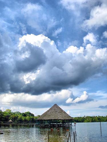
Finally the Mountain (improperly named because it is a flat area) or Forest on the slopes of the Andes to the east, constitutes 62% of the territory and does not add more than 9% of the population, which inhabits only the banks rivers, and the few parts that are possible to be cultivated. The potential wealth of the area is huge, and currently work is underway to extract oil.

Rivers are the major routes of the region and all they form the great Amazon, the largest river in the world, on whose banks is Iquitos, capital of the Peruvian jungle.
This is a simple overview of what the Peruvian fair land, knowing it is not difficult, either, and I assure you reach the landscapes and customs you will see will be stored in your mind.

Welcome to Peru!
One Response to “Peru is a country of many contrasts millennium”
Leave a Reply
You must be logged in to post a comment.
marzo 18th, 2012 at 6:48 pm
[…] in the Puno region, whose capital is the city of Puno on Lake Titicaca, located in southern Peru for 3 827 m above sea level and climate has a maximum temperature of 22 º C and a minimum of 14 º […]