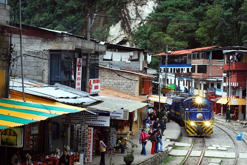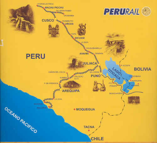
The train route linking Machu Picchu to Lake Titicaca can give the alternative option for travelers to explore this Wonder of the World. We need to know what are the points of the route to greater knowledge of the area, also your camera ready for shots and ready here we go …
Places to go:
1. Cusco: Huatanay river, green fields dotted with willow trees and eucalyptus, passing outlying communities built around colonial churches.
2. Oropesa: 24km (15 miles) from Cusco, new city
A 32Km (mile 20) before reaching the lake Muina, the train turns left, crossing the road along the valley to join the Huambutio Vilcanota River while descending into a deep gorge before widening into the great gorge Urubamba.
3. Rumicolca: 40km (mile 25) near the large stone entrance of the same name you saved the southern approach Inca Cusco. For the much earlier Wari culture, Rumicolca served as an aqueduct.
4. Andahuaylillas: 45km (mile 28) The church is considered one of the jewels in the crown of colonial Cusco, next to a magnificent system of walls and paintings of the colonial era in various religious themes.
5. Urcos and Urcos Lake: 60 km (mile 37), popular spot for weekend residents of Cusco, and according to local legend, a repository for gold hidden by the Incas to avoid the Spanish melting their sacred objects.
6. Cusipata Villages (80km, mile 50) and Checacupe (100km, mile 62): pre-Inca ruins and Inca adorned with colonial architecture.
7. Raqchi: 120km (mile 75), ruins of the great temple of Viracocha, the creator god, you can see off to the left. A little farther on the train to Sichuan, trade island in the middle of a barren landscape. Here Aymara women ferry their goods around this important market town with taxis on tricycles
8. Marangani: 185 km (mile 115), descendants of English manor houses of wool growers a century ago. Here are the fertile hills altollano known as the Altiplano.
The train continues to climb to thermal baths at Aguas Calientes La Raya, Puno 200km.

At 4320 m above sea level, this is the highest point on the trip, a cool place away surrounded by snow covered peaks in fog or drizzle. Crossing the great divide of the waters, the train travels through a sea of meadows and villages
9. Juliaca: 281km (mile 175), market town before reaching Puno
10. Puno and Lake Titicaca: Final point.

See you tomorrow…
Leave a Reply
You must be logged in to post a comment.
Recent Comments